Our day started early, with a 3 AM alarm followed by a hot shower. Norm
stayed at our house Friday night. Stu pulled up at 3:30AM. He only had
30 minutes sleep, as he had to work until midnight. We packed Stu’s Cherokee
and were off by 4AM for a one week trip to the San Juan Mountains, including
a six day backpack into the Weminuche Wilderness Area and a 2-night
stay in Ouray. Stu had only 3 peaks remaining to complete “The Colorado
Grand Slam” – climbing all 54 14ers. On this trip we planed to climb two:
Mt. Eolus and Mt. Sneffels.
We took turns driving. With hardly any traffic, we were in Silverton
by 10 AM. The drive between Ouray and Silverton on US550 was spectacular.
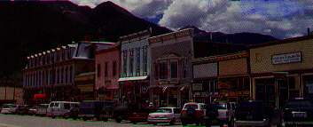
Silverton hasn’t changed much since we last visited there in 1973. The
two main streets, lined with restaurants and souvenir shops, were bustling
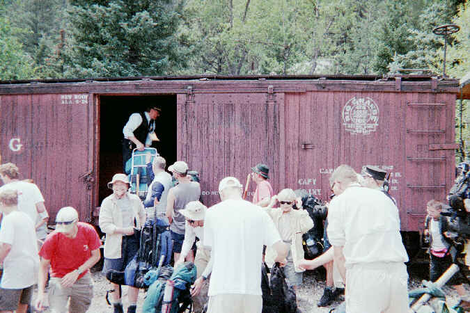
with tourists. At 11:15 AM , the first train pulled into town. For some
strange reason, the Durango & Silverton RR only offered a Needleton
stop for backpackers on the last train of the day at 3:15. The ticket agent
told Stu that an earlier train could often be arranged with the conductor.
So, rather than settle for a late hike up to Chicago Basin, I approached
the uniformed man and asked about the possibility of boarding the 1:15
PM train. Out of the question! We would have to wait. Not to be too easily
thwarted, Stu approached an employee, and was also told to wait. So we
went to lunch at the “Bent Elbow Saloon”, listened to olde time piano and
resigned ourselves to the last train of the day. After lunch, with little
hope of success, Kris and Stu talked to the Conductor. We were on for 1:15!
It pays to talk to the right person.
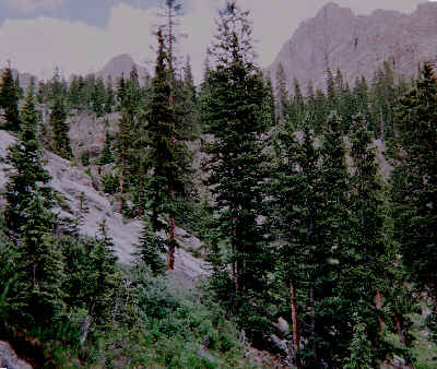
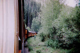
The train ride was a great way to get to the remote trailhead. The
steep mountain scenes along the Animas River are picturesque. The ride
to Needleton takes about an hour. By 2:30 PM, we were waving at the train
and starting our hike across the bridge. The trail follows the Needle Creek
due east into Chicago Basin. It is 6 miles and 3,000 feet elevation gain
to the Basin. We enjoyed the hike and indulged in a sit-down gorp break
every hour. Outbound hikers relayed the information that 80 hikers got
off the morning train from Durango. At about 6:30PM, we found a fine campsite
at about 11,000 ft. We pumped our water, set up camp, ate supper and slid
into the sleeping bags by 9:30PM. It was a long, but successful day.
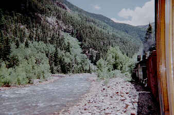
The Anamus River and Ol' #468
Starting at the Needleton Flagstop
We woke at 4:30AM, feeling refreshed. The sky was clear, so we decided
to climb Eolus first, as it was highest on the list of priorities. We hiked
up to the upper basin at dawn, with the first sun hitting the tops of the
peaks. While the six miles of trail from the Animas River to the Basin
is a pleasant walk along a wooded bank, the full impact of the Chicago
Basin is felt in the upper valley, as the view of the surrounding peaks
opens up.
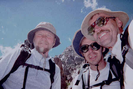
Ascending the headwall up to the Twin Lakes, the trail passed by several waterfalls. At the Twin Lakes, the trail traversed left to Eolus and right to Windom and sunlight. In 1993, this upper valley was mostly snow, this year it was almost completely dry. Just below the slanting shelf, Norm and Kris decided to go at their own pace. We all seemed to be feeling the effects of the altitude. Stu and I continued. The weather was now looking questionable, so Stu went for the summit. I climbed North Eolus, and we waved from peak to peak at 10AM, as we topped out.
It actually did rain that afternoon and evening. Resting inside a dry
tent while it is raining can be quite enjoyable if it is not the sole activity
of the week! We felt pleased to have succeeded on Eolus, as a week of rain
is quite possible in Chicago Basin.
It was another early morning. No rest for vacationing climbers,
I’m afraid. Up at 4:45AM, we performed the morning routine of hot water,
oatmeal, secure the camp and pack the packs. It seemed to take a bit over
an hour, regardless of day or plan. It was a constant delay, a fixed span.
If the trees were on fire, I think it would have taken the same time. All
of us felt much better, which seemed to support the idea that we were adjusting
to the altitude. Norm, Kris and I all used some Diamox on Sunday. As we
were walking up the trail for the climb du jur, feeling fit and strong,
we talked about the great feeling on about the third day of active vacations.
For us office and lab dwellers, the body seems to “tune-up” after about
three days of hiking or climbing. We were all feeling great on this third
morning.
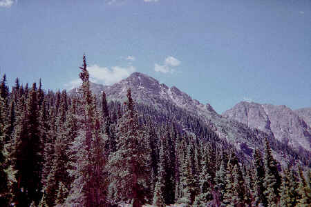
Jupiter was the day’s objective. Being a Centennial, it does not get near the attention that Windom, Sunlight or Eolus receive. The approach follows the Columbine Pass trail up to a drainage southwest of Jupiter. This was the first time up this side of the basin. After five treks up the Twin Lakes trail, this was a pleasant change of perspective. The stands of Douglas Firs on the south side of the basin are much larger. It is probably a result of greater snow pack and moisture on north-facing slopes. Assuming that the source of water, in the form of rain and snow are roughly equal across the basin, the vegetation provides a dramatic demonstration of retaining snow pack and the lack of the melting and evaporation on the sunny side of the valley.
We left the trail right at the creek flowing out of the drainage. Walking up the drainage just below timberline, there are many signs of past mining activity. We found parts of an old cast iron stove, but no trace of a structure. Was the stove used here or jettisoned prior to crossing the pass? There must be many stories locked up in these old relics. The mining activity spanned the years 1870-1930. Here we are in 2000, camping and climbing in a “Wilderness Area” that is near pristine. It has truly been returned to an almost natural state and preserved for this and future generations to enjoy. While there is a romantic notion of the miner’s life, this basin was probably not the Rocky Mountain jewel that we currently know back at the turn of the century. The Weminuche Wilderness area is a great example of re-claiming land as wilderness.
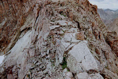
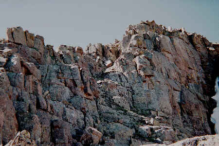
The route up Jupiter follows directly up steep, grassy slopes to the southwest ridge, and then along the ridge to the summit. The grass slope was a slog. By the time we made the ridge, we all had our fill of the steep, slippery stuff. What a contrast awaited us at the ridge! The other side of the ridge was another world – vertical spires and cliffs. The north face of Jupiter has quite a different character, indeed. It is the symmetrical, cliffy pyramid seen from the waterfalls, that we now experienced up close. The break spot reminded me of the Chasm View on Longs Peak. The spires were not on the same scale as the Diamond, but the contrast from grass slopes to the Jupiter cliffs had the same impact as that from the Boulder Field to Chasm View.
The ridge was a welcome change in scenery. The dramatic views to north
and the vista of the Columbine Pass basin to the south made for a pleasant
ridge walk to the summit blocks. Here, we left our packs and enjoyed that
final bit of scrambling to the top. The ridges were quite broken and extended
southeast to Grizzly Peak, north to Windom and south to Columbine Pass.
We were surprised to find that John Landers, a CMC acquaintance, had climbed
the peak on Sunday – small world. Here we had this feeling of being
off the beaten path on a Centennial.
Another day, another climb. We found that we were rising a bit later
each day. We had abandoned the plan to cross over the two high passes to
the Ruby Creek Basin on Monday. By now, we were all feeling fit. This opened
up the possibility of a second chance at Eolus for Norm and Kris. We were
soon hiking up the trail to the Twin Lakes, watching the first sun light
the tops of the peaks surrounding the upper basin. Having just climbed
Jupiter, it looked a bit different to us. We had gained that familiarity
that only comes from the soles of a boot. There is an eroded stretch of
the trail that climbs steeply up from the floor of the Basin to the Twin
Lakes shelf that we called the “Namche Stretch”. It resembled the eroded
steep trail going directly up the side of the Namche Bazaar bowl from the
Everest Museum campsite to the shelf leading to the Everest View Hotel.
Both have three-foot switchbacks from rock to rock, on a dusty, 40-degree
grade.
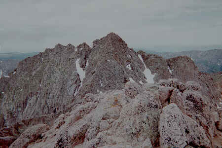
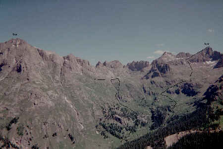
From the rocky moonscape of the Twin Lakes shelf, the route traverses the grassy south-facing slopes of North Eolus. The bright yellow fields of Alpine Avens and Yellow Paintbrush against the high views of the peaks are spectacular. The bowl just south of Eolus’ Summit was an ice axe and crampon snow climb in July, 1993. Today, the bowl has only a small patch of snow. I wonder if this is the normal year-to-year variation in snow pack, or if we are seeing a steady shrinkage of the few remaining perennial snowfields in Colorado? The ramp up to the ridge is now completely off snow. There is a lot of rounded rocks with gravel patches. We made our way up to the “Sidewalk in the Sky”, between Eolus and North Eolus. Kris decided as we were almost across this section, that she was not enjoying the exposed scramble. I went back to the start of the Sidewalk with her, while Norm and Stu continued the climb. I climbed alone from there to rejoin Norm and Stu. It was another perfectly clear day and I was enjoying the scramble without worrying over the weather or pace. I ended up taking several shelves and ledges that seemed to lead to nowhere. Finally, I was just below the summit. Stu and Norm waited there for me. What a fine thing to do on a vacation day! The views from Eolus are amazing. We saw Sunlight, Windom and our new friend Jupiter to the east, and Turret, Pigeon and Monitor to the northwest. Off in the distant northeast is an impressive and aptly named Jagged. This will be one of our goals on a future trip.
Back in camp, we indulged in a wash in the Needle Creek. It is hard
to believe how refreshing it is to bath with cold river water and dry in
the sun. Stu cut his Cussler book in half so that Kris could have something
to read. We had taken our books out during our struggle to bring our pack
weights down. We even had some time to try out the hammock and lay in the
sun.
We woke at 5:30AM. Stu, Norm and I had breakfast and packed up for
the climb du jur. Kris slept in to give her feet a rest, as we were moving
the camp in the afternoon.
We were out of camp by 6:30AM. Our goal for the day was an un-named sub-peak at approximately 12,900 ft. along the NW ridge of Aztec Mountain. It was a fine objective. We had stared up at it each evening as we pumped our water out of Needle Creek. There was frost on the shrubs where we crossed the Needle Creek. It felt like autumn. We started up the NE ridge of our peak, which ramped up steadily through firs. We followed and old mining track for a while, but we were soon working our way over down trees. We held to the broad top of the ridge and soon came across the ruins of an old log cabin. We took a break there and tried to imagine what had transpired there a hundred years before.
From the cabin, we were soon moving up steep grass and gravel. We made it up to an outcrop in one of the last stunted stands of trees. The view of the valley from this point really opened up. It was yet another perspective of all of the familiar features of the upper basin. Directly across the valley from our perch was the cirque between UN12834 and Eolus. The sun was just making it over Eolus’ flanks and turning the cirque from a dark drab to bright green. We sat and watched as the sun reached the waterfalls at the far end of the basin, first hitting the treetops and finally reflecting off the water. We had another fine day ahead of us with a perfectly clear blue sky.
The climb now became an interesting scramble. Unlike the Fourteeners,
the peak has not had many climbers, so a route is not always obvious. The
likelihood of finding loose rocks is greater. Blocks and rocks ready for
some slight force to dislodge have not been disturbed by hundreds of climbers.
Several times, we had to try alternate routes. While the scramble was great
fun, the progress was slow. If we were to move camp to a site 5 miles closer
to the train stop this afternoon, we figured (and you’ve got to figure)
we had to turn around by about 10AM. Initially, we thought that schedule
would be no problem, but at 9:45, we were having some doubts. We took a
short break and discussed our choices. If what was above us goes as slow
as the last 30 minutes, we’ll never make the top and still set up a new
camp in daylight. We looked at the ridge directly above us, and it did
not promise to be any faster than the ground we just covered. Stu next
tried maneuvering around some blocks on the north side of the ridge. It
was necessary to slither around one large rock to get past a corner. Another
15 feet of blocks brought us to an easy, broad ramp up to the summit ridge.
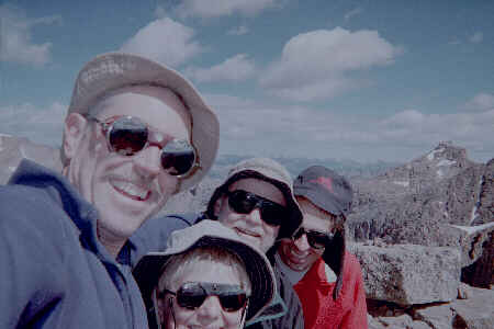
At 10:09AM, we yelled ‘KRIS’ in unison from the summit, as we could see
directly down to the campsite. There were two rocks supporting a summit
stick. No register here! I think Norm, Stu and I agreed that our “Fourth
of July” summit was as good as any of the more popular peaks.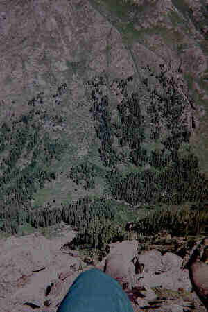
Looking down to Camp1
After a coffee and cream of wheat breakfast, we broke camp and packed
up. We were on the trail again by 8:10 AM. We hiked to the Needleton
Train stop by 9:20 for the 10AM train. We washed up a bit in the Animas
River so that we’d feel a bit more presentable to mingle with the day-trip
tourists on the train. This was more a refreshed state of mind -
removing 6 days of trail dust would take a more serious wash-up!
The locomotive is quite impressive as it rounds the bend. The trackside
hikers are eye-level with the center of the wheels. Steam and coal smoke
combined with shrill blasts from the whistle add to the effect. The conductor
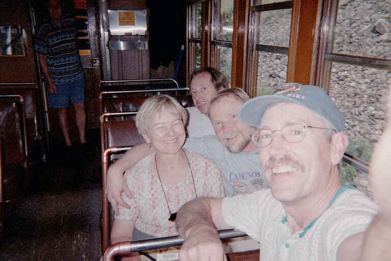
put our backpacks in the baggage car and took our tickets. Soon we were
seated, and watching the mountainous scenery of the Weminuche Wilderness
chug by at a top speed of 17 MPH.
The train ride from Needleton to Silverton takes about one hour. Silverton
was bustling with tourists. Most tourists are riding the Durango-Silverton
excursion train, but there seem to be quite a few bikers (as in Harley
Davidson) as well. The mean age of the bikers would seem to be around 50
in Silverton. The town had a holiday atmosphere. We packed the car in front
of the ice cream stand. No time lost there! We toured a mining museum and
had lunch at “The Shady Lady” before heading up to Ouray.
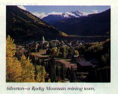
At Ouray, we started into the two-day resort phase of the trip. We stayed
at the Best Western Twin Peaks Inn and enjoyed the pool, hot tubs and shuffleboard.
The Box Canyon was only a five-minute walk from our motel, so we broke
into tourist mode for an hour to see the impressive falls that drop about
250 feet within a narrow rock cavern.
Thursday, July 6, 2000
We woke from a broken sleep at 6:30 AM. The night’s sleep was interrupted
several times as I started sliding off the ThermaRest toward the downhill
side of the tent. The campsite for Camp2 that we found along the Needle
Creek had a spectacular view of falls, even if it was not 100% level. It
was 10 minutes hike down stream from the New York Creek Bridge and about
one hour from the Needleton flag stop. We were off of the main trail 20
yards and situated right on the bank of the creek.
After supper, we enjoyed the first bed in a week for a glorious night’s
sleep.
We were up at 4:45 AM. Stu and Norm joined us in our room for bear
claws and coffee. All of us had re-packed our packs the night before for
a day outing to Mt. Sneffels. We left for Yankee Boy Basin at 5:40 AM.
The basin was spectacular this year. The fields were carpeted with wild
flowers: Blue Columbine, King’s Crown, Indian Paintbrush, Owl-Clover, Mountain
Bluebells, Alpine Avens, and all as thick as grass.
We parked and started out at 6:45 AM. There were high clouds, even at 6 AM. The breeze seemed a bit cool as we started. After 15 minutes of hiking, the trail topped over one of the grassy hills and we were surprised to see a Suburban, canoe and tent next to a tundra lake. The owner seemed a bit sheepish greeting us, as he was probably violating half a dozen restrictions camping and canoeing there.
The climb up the scree field to the saddle was a true trudge. Stu made it first. We had a short break, and then continued up the couloir to the blocks at the summit ridge. We summated at about 10 AM. There were several locals from the Ouray area on top as well. Congratulations to Stu! He had finished all 14ers except the private Calebra Pk. We celebrated his Grand Slam on Sneffels instead! In the evening, we had a fine celebration dinner at The Pinon restaurant.